Globes, maps and plans are different way of representing our world.

A GLOBE is a model of the Earth. It shows the Earth as a sphere.
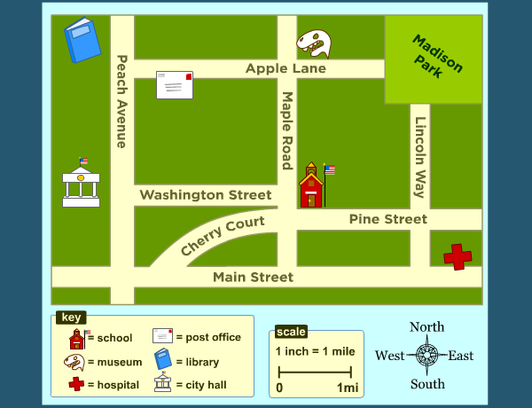
A PLAN is a drawing of a place. It shows SMALL areas of land.
A plan shows buildings and streets from ABOVE. Plans have street names and symbols.
A MAP is a drawing of a place. It shows LARGE areas of land from ABOVE.

The COMPASS ROSE shows the four cardinal points: north, south, east and west.

CONTINENTS are large areas of land.
They are: North America, South America, Europe, Asia, Oceania, Africa and Antarctica.
OCEANS are large areas of water.
They are: Pacific Ocean, Atlantic Ocean, Indian Ocean, Southern (Antarctic) Ocean and Arctic Ocean.
¡Ponte a prueba!
Identifica continentes y océanos
Identifica rápidamente continentes y océanos
Look at this map. It's our continent!
A continent is a very big area of land. This continent is Europe.

Spain is a country in the south of Europe. Can you find it on the map?
ME ON THE MAP
¡Ponte a prueba!
Realiza las siguientes actividades. Cuando hayas acabado, pulsa en TERMINADO. Después pulsa en COMPROBAR MIS RESPUESTAS y ...¡hecho! Ya puedes ver cómo te ha salido.
Revision (la puntuación máxima es 9)